It was difficult to leave the viewpoint overlooking the Flaming Gorge (Red Canyon and Flaming Gorge. Memorial Day 2019 trip, part 5) but we managed, turned left and took a side road.
You all know how boring it is to go straight to your destination...
It's always more fun to explore unknown routes and take the winding
road instead of the fastest one. So we
went down the road we knew nothing about - Sheep Creek Loop. We
now
know that this was the best decision, because it was an amazing path to
explore, but at the moment we had some doubts about whether we were
doing the right thing. The
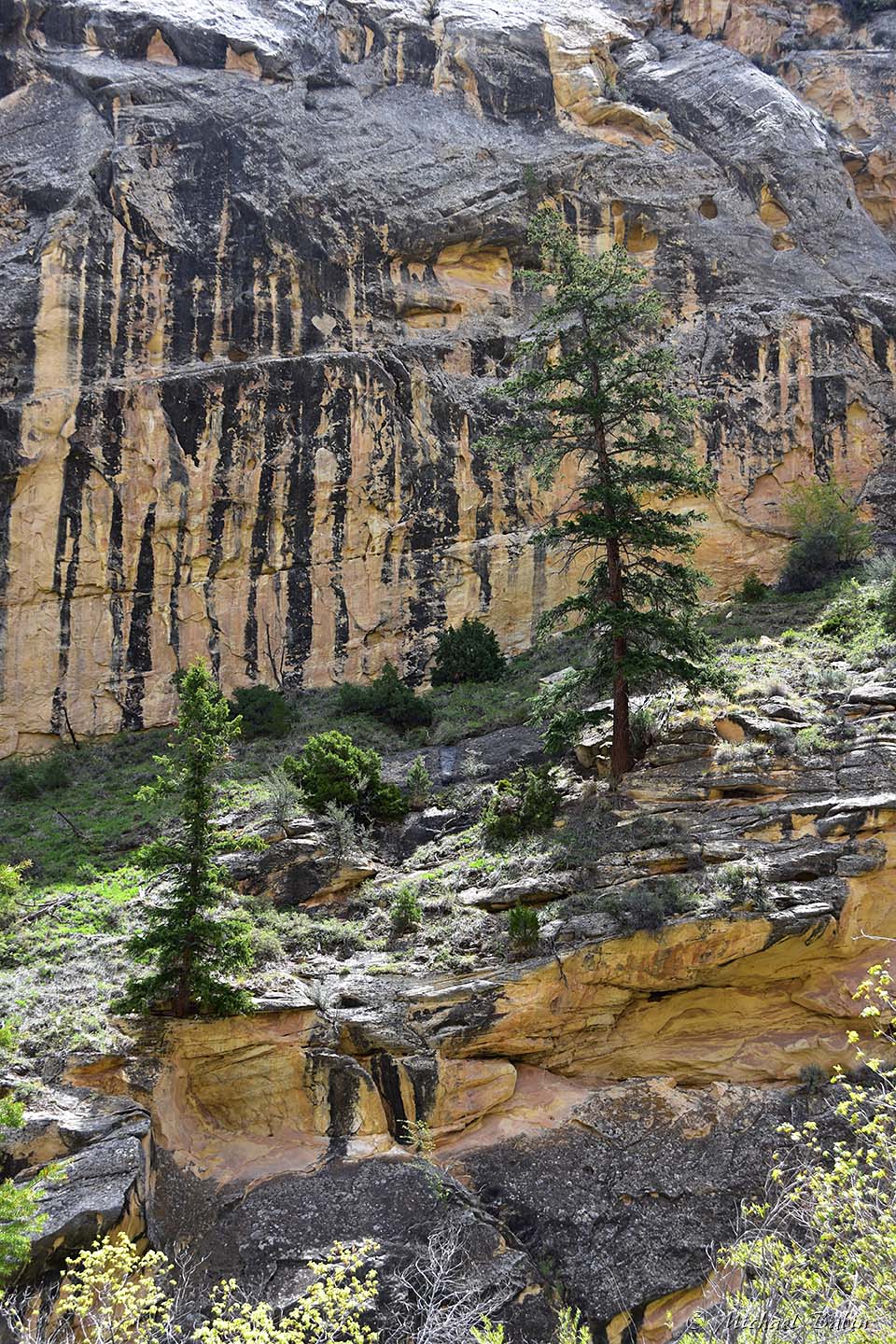
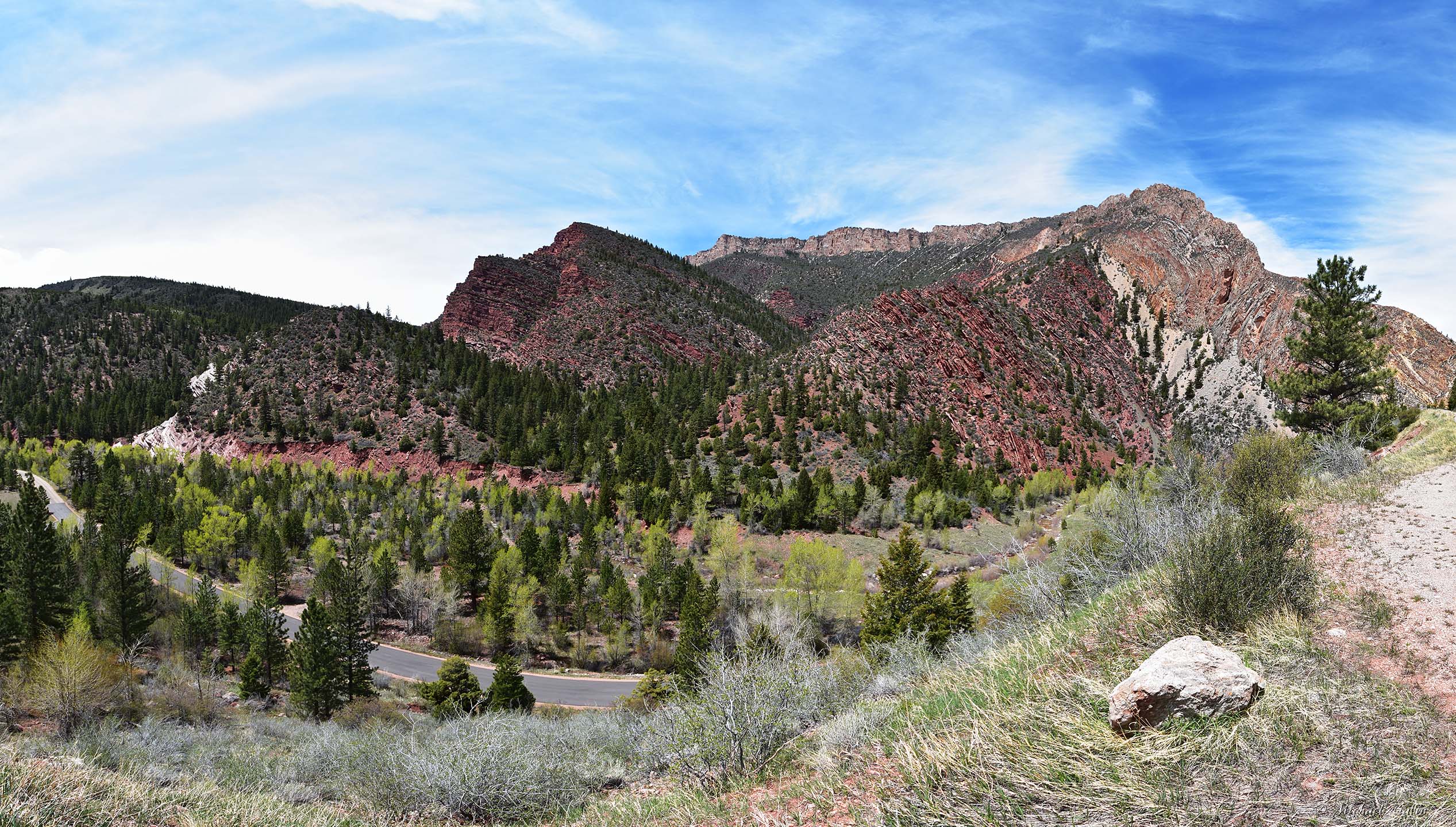
road runs at the bottom of a narrow canyon (this is a challenge for
taking the pictures - everything is way too close) and allows you to
travel
through the time when you drive along it.
This road follows the visually dramatic Uinta Fault and then loops back to Hwy 44.
An interesting display of unique rock formations can be seen along the
fault, including towering monoliths along with rock that has been
fractured, jumbled, discombobulated.
Here are a few more details about these formations:
Sheep
Creek Canyon Geological Area is located in northeastern Utah on the
north flank of the eastern Uinta Mountains. About 800 million years of
geologic history are showcased within the geological area, from some of
the oldest sedimentary rocks in Utah to the classic faults and folds of
the Laramide orogeny that uplifted the Uinta Mountains about 70 to 34
million years ago.
Ten bedrock formations that comprise about 6,600 feet
of rock are exposed in northwest-trending bands that dip northeastward;
the oldest rocks are exposed in the southern part of the geological
area and the bands of rock young to the north.
The oldest rocks in
Sheep Creek Canyon comprise the middle Neoproterozoic formation of Hades
Pass of the Uinta Mountain Group. These rocks are about 770 million
years old (OK, to set it straight, let's write it with numbers -
770000000 years old) and were deposited in a basin by marine and
non-marine
processes. After the deposition of the Uinta Mountain Group, a prolonged
period—about 410 million years—of interspersed deposition and erosion
occurred, with erosion prevailing. Any rocks deposited during this time
were later eroded. Rocks of Mississippian age were laid down on the
unconformable (erosion) surface that formed on the slightly tilted Uinta
Mountain Group. Marine conditions dominated the rest of the Paleozoic,
with an interruption during Late Pennsylvanian to Early Permian time as
the eolian Weber Sandstone was deposited. The youngest rocks in the
geological area belong to the Triassic Dinwoody Formation.
The Uinta
Mountains rose along the Uinta fault zone during the latest Cretaceous
through early Tertiary time. Precambrian, Paleozoic, and Mesozoic rocks
were tilted steeply northward, folded into monoclines, and faulted.
Thousands of feet of rock were eroded from the growing highlands,
eventually exposing the Precambrian core of the Uinta Mountains.
The
landscape and drainage system of the eastern Uinta Mountains, which
includes Sheep Creek Canyon, continued to change as the Gilbert Peak
erosion surface formed in Oligocene time and was later tilted during the
Miocene extension of the Uinta Mountains. Renewed uplift of the
Colorado
Plateau during Basin and Range extension that began about 15 to 10
million years ago rejuvenated the upper Colorado River Basin and caused
active headward erosion of many rivers.
It sounds very scientific ;) but the only thing that matters is
this road is amazing and it's impossible to forget it if you've been
there. The loop is 13 miles and it took over an hour to complete those
loooong miles. Actually, we spent most of the time on the 4 miles
section in the oldest part of the canyon. I'm guessing 50 minutes for 4
miles and 10 minutes for the rest (9 miles).
Wanna to see our next stop? Click here - Flaming Gorge Dam. Memorial Day 2019 trip, part 7.
Pictures were taken on May 26, 2019.


No comments:
Post a Comment